 Don't have an account?
Sign up
Don't have an account?
Sign upSearch
i.e. "Gypsy Moth", "Drake", "Azores" or "Shanties"
We are affraid that your web browser is relatively old and requires an update!
Team of WeSailors.com recommends make an update to the newest Internet Explorer version.
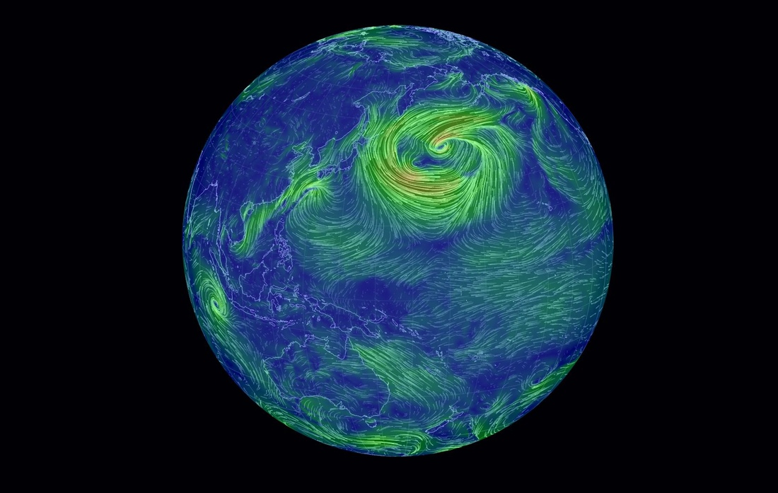
Real time Earth Wind Map
Date: 2014-01-19 21:41:03

Like the US-specific wind map created by designers Fernanda Viégas and Martin Wattenberg earlier this year, Earth Wind Map is interactive. Click and drag the globe and you'll spin it in place, then wait a few seconds before the data appears in the form of snaking lines. Gentle breezes are thin strands of green, strong winds are long streaks of bright yellow, while the strongest currents are an angry red. Take a trip around Earth Wind Map's globe now and you'll be able to compare the light summer winds currently wafting across northern Brazil with the swirling gusts off the north-east coast of Japan, a hypnotic and colorful reminder of our planet's wildly changing weather.


| Community | Service | Information | Join us! |
|---|---|---|---|

 |